––––––
F o t i n i
K a l l i k o u n i
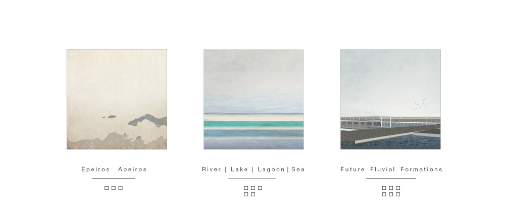
This research examines the Epirus region as a historical, natural and agricultural land and is divided in three parts :
EPEIROS APEIROS
The first part is about a general research of the region of Epirus as well as a specific research about the Epirus waterscapes.
LAKE | RIVER | LAGOON AND THE SEA
In the second part, it is been examined the Arachthos River, in south of Epirus, as a natural mechanism that used to change and is about to change.
FUTURE FLUVIAL FORMATIONS
Finally the third part is a site specific architectural project that proposes water formations along the mouth of Arachthos river.
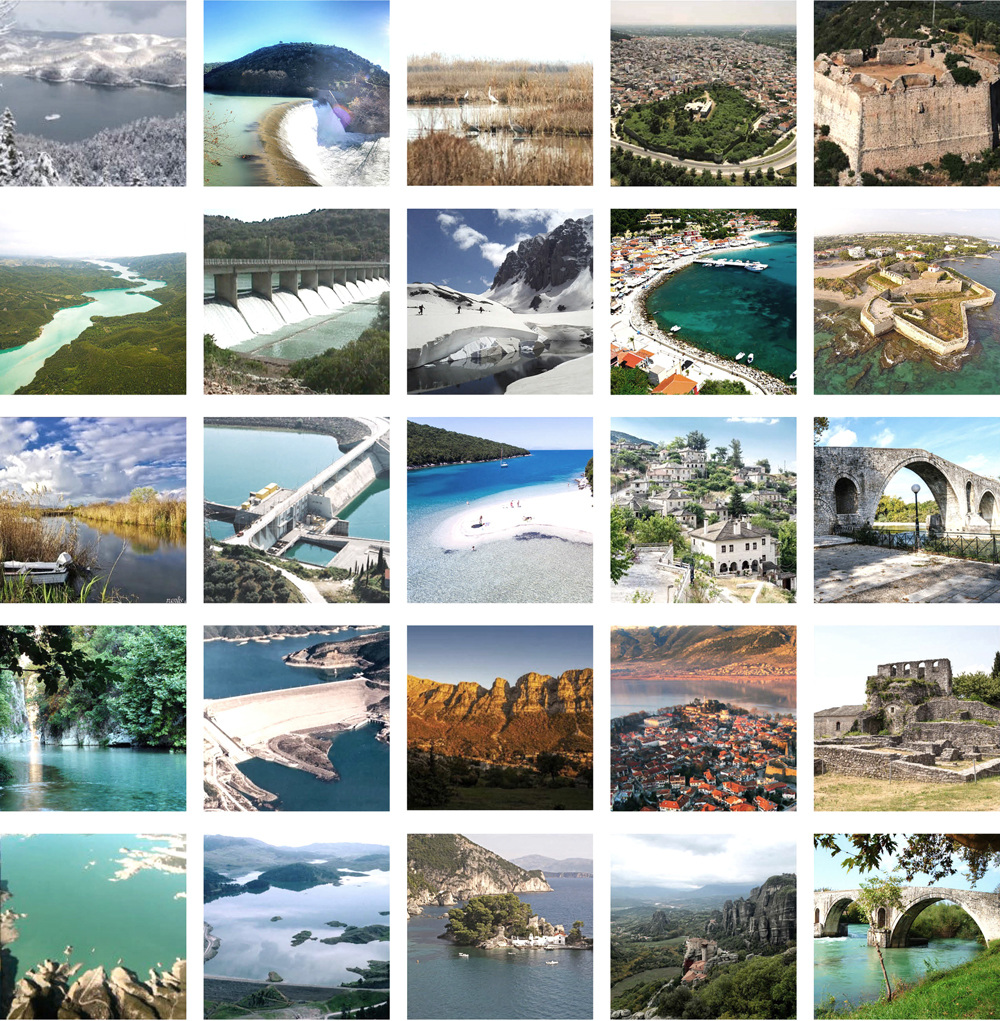
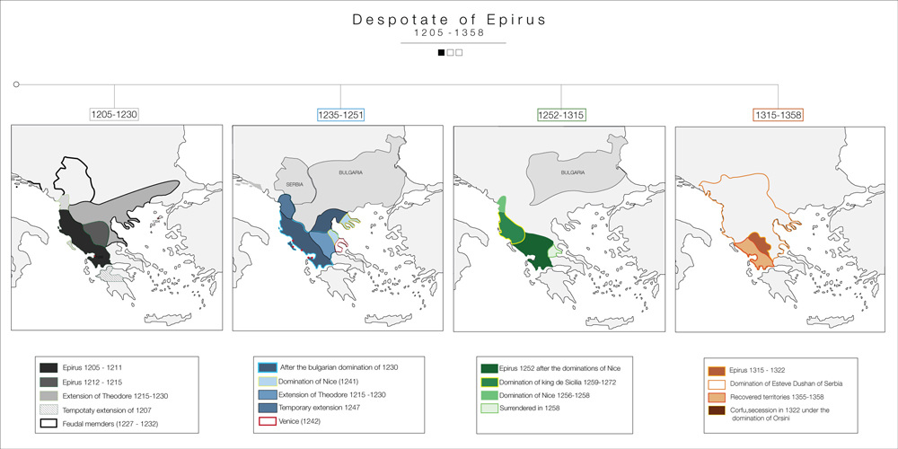
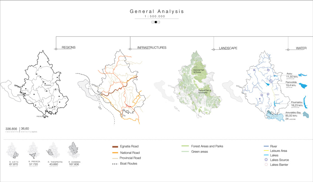
Epirus is a geographical and historical region in southeastern Europe, now shared between Greece and Albania. It lies between the Pindus Mountains and the Ionian Sea, stretching from the Bay of Vlorë and the Acroceraunian mountains in the north to the Ambracian Gulf and the ruined Roman city of Nicopolis in the south.
The name Epirus is derived from the Greek: Ἤπειρος, Ḗpeiros (Doric: Ἄπειρος, Ápeiros), meaning "mainland" or terra firma. It is thought to come from an Indo-European root apero- 'coast', and was originally applied to the mainland opposite Corfu and the Ionian islands.
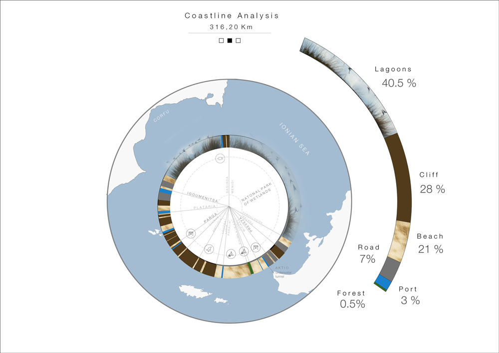
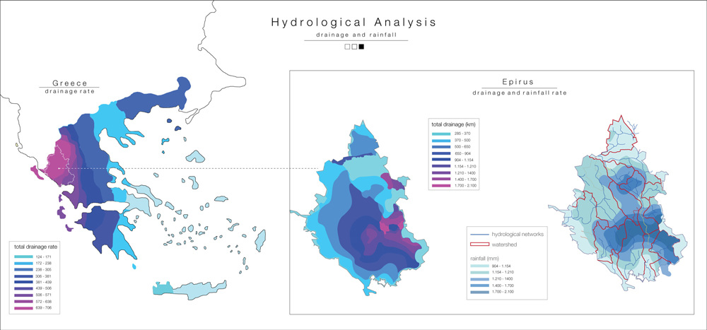
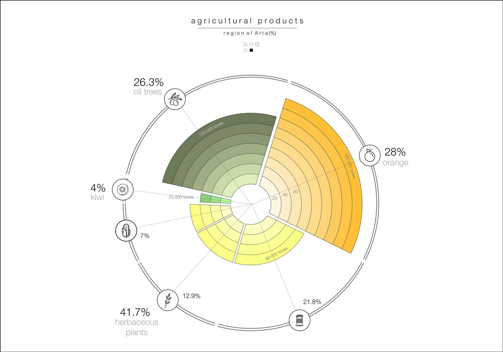
Because of its unique landscape, it is the region with the biggest drainage rate in Greece. The element of water is very intense even though it is basically mountainous: the lagoons that occupy the 40% of the coastline, the natural and artificial lakes that irrigate the agricultural fields and the river’s flow that contribute to the production of renewable energy, prove that wetlands are one of the most important characteristics of its landscape.
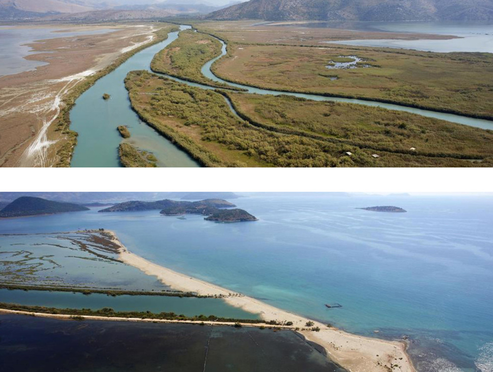

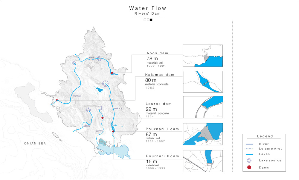
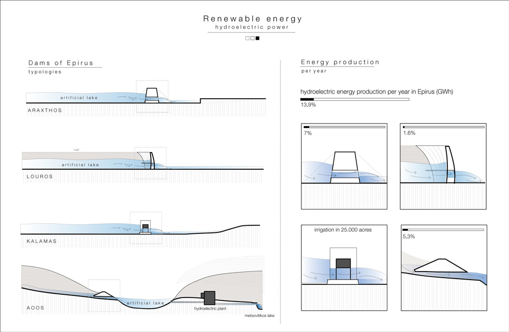
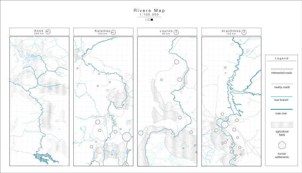
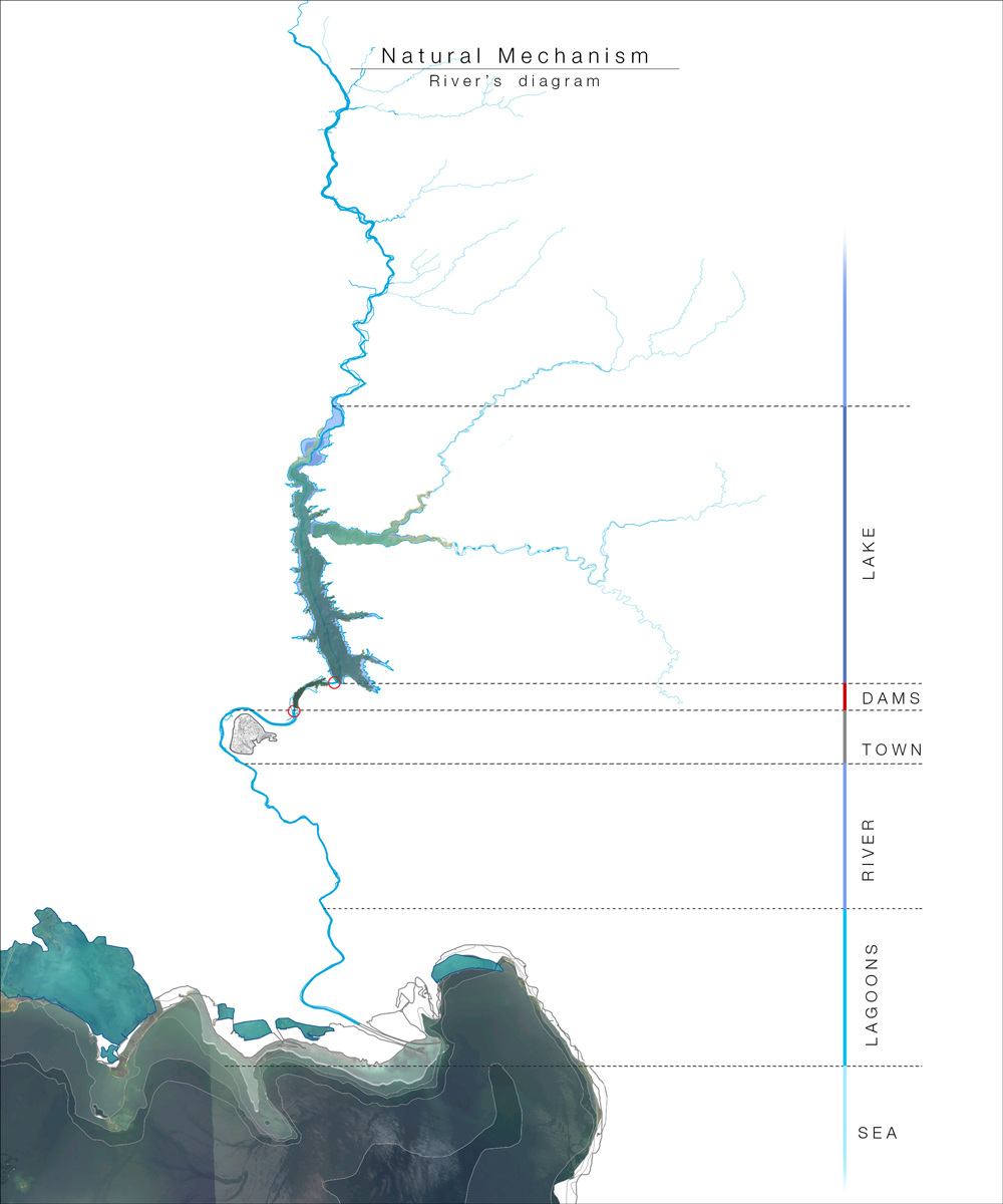
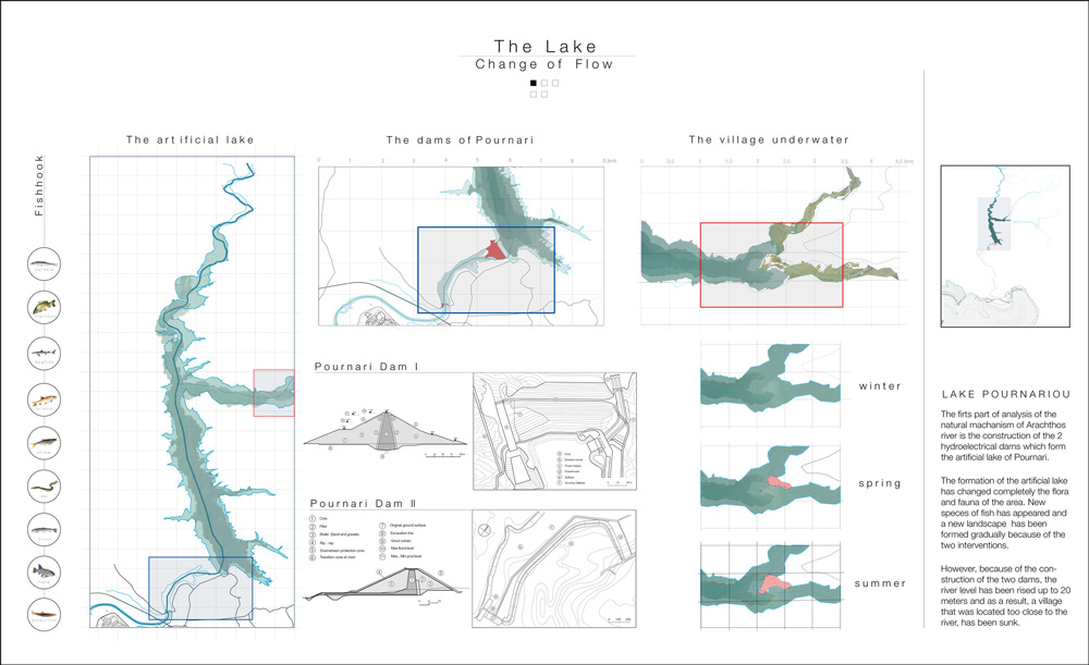
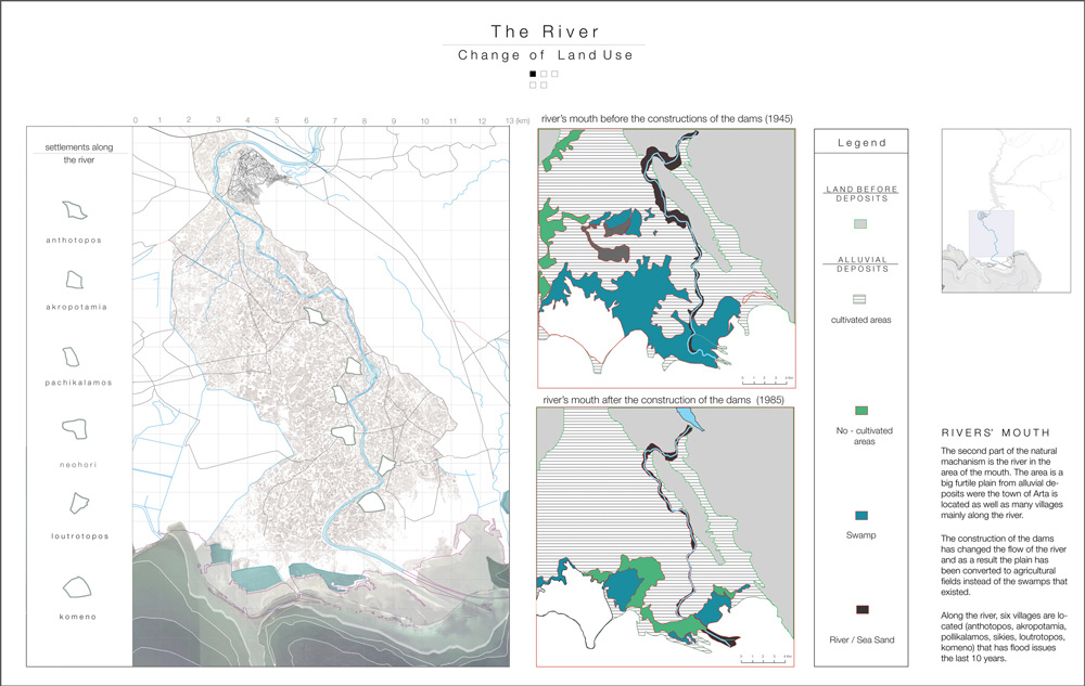
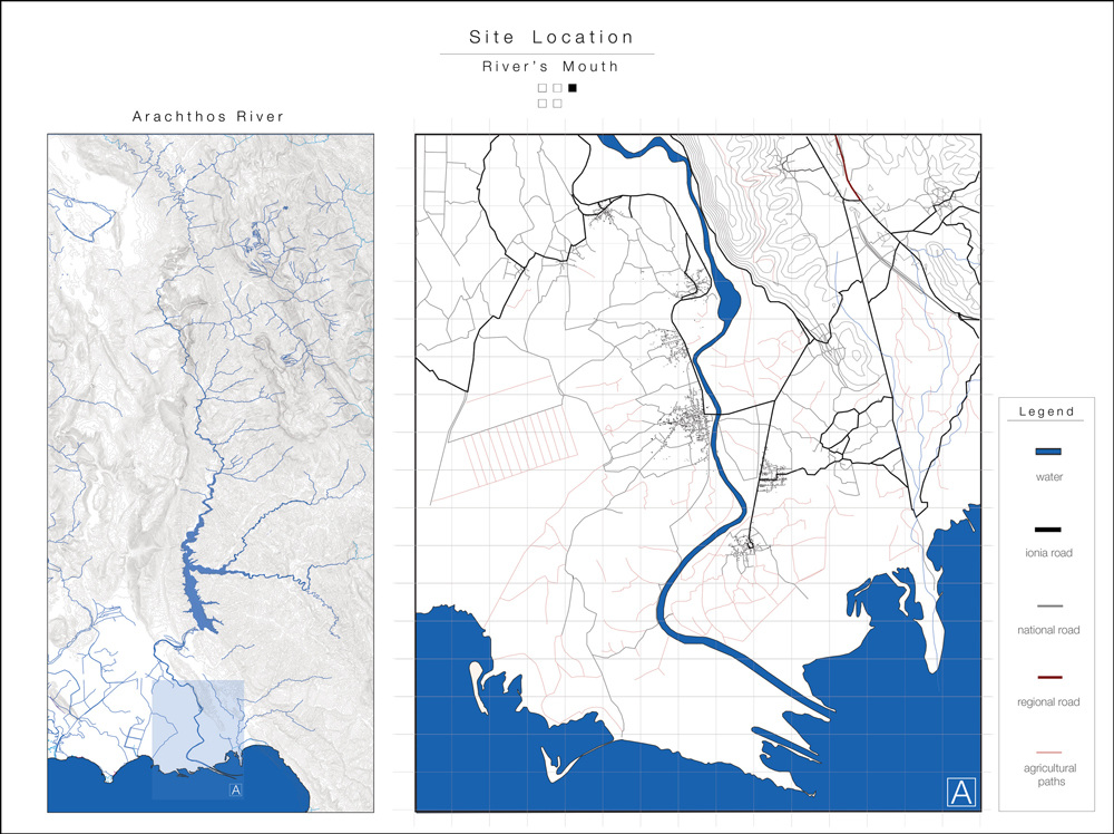
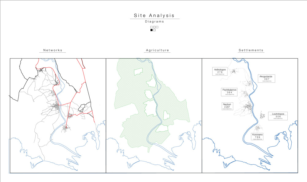
Arachthos river is the biggest (135 km) and most impetuous river in Epirus which stems from Pindos Mountain and flows out to Ambrakikos Gulf. The research is focusing on river’s mouth which has dramatically changed the last 40 years due the construction of two hydroelectric dams.
The changes are obvious:
A big lake has been formed in order to prevent flood damages, produce hydroelectric power and irrigate the meadow’s agricultural fields.
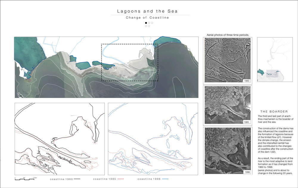
The meadow has been transformed from endless swamps to a fertile agricultural land because of the alluvial deposits and the coastline has been allocated and partially corroded through decades due to reduced water flow.
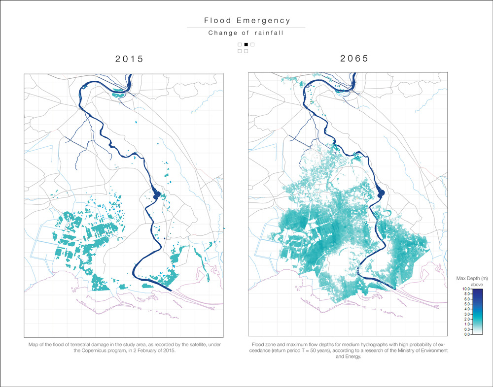
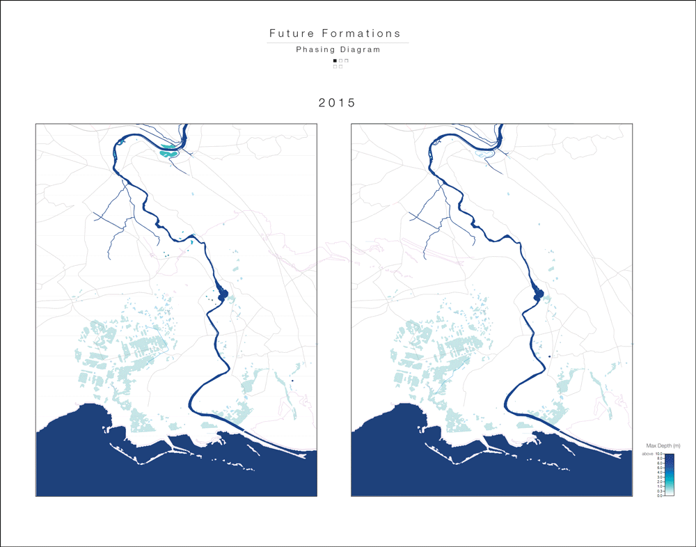
However, the big changes are about to happen. Due to climate change, annual rainfall has increased, therefore dams can’t control rivers flow. As a result, a big flood emergency has already occurred in 2015 and is about to cause damages the following years.
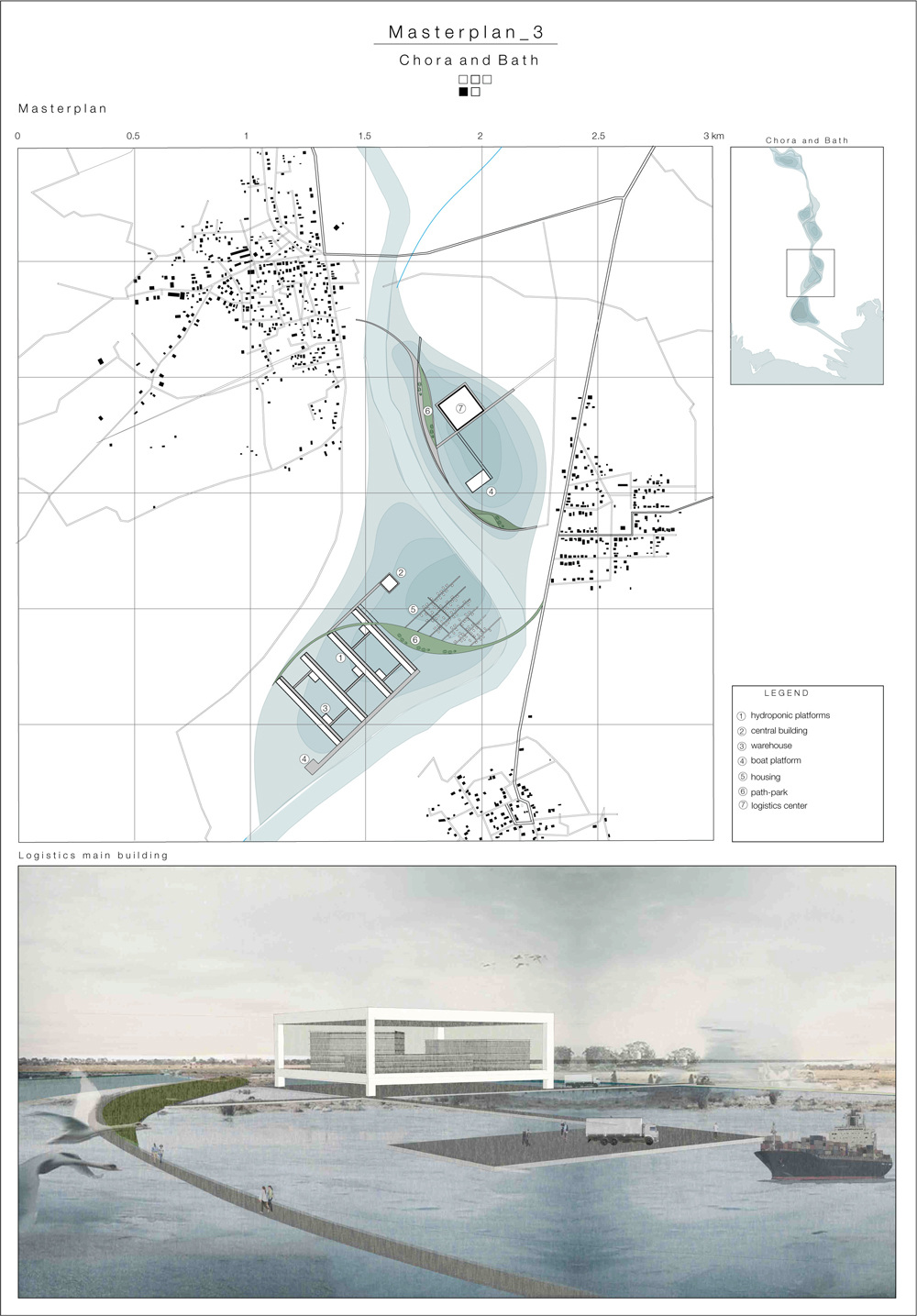
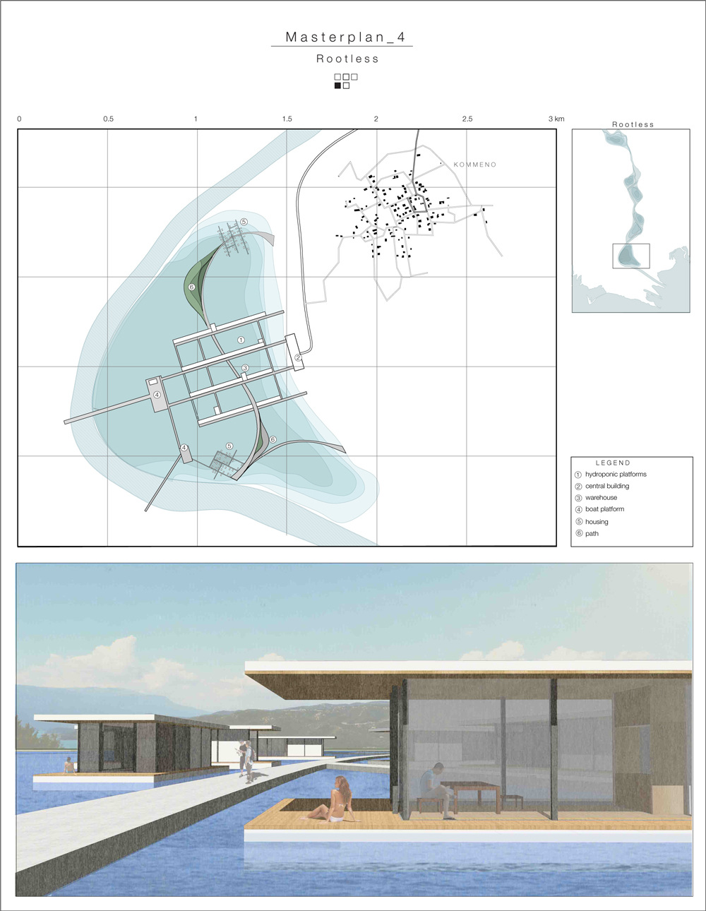
Future Fluvial Formations
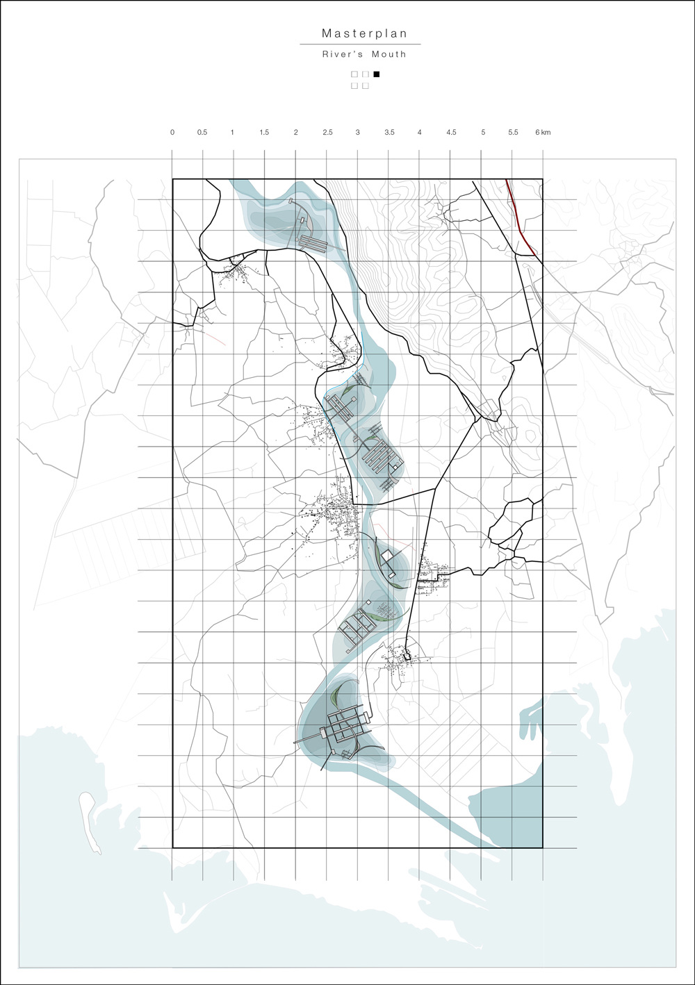
River’s mouth is threatened by catastrophic floods. The agricultural meadow and the six villages along the river are about to face serious flood damages. Meadow’s tendency to turn into the initial swamp situation can’t be prevented.
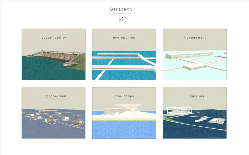
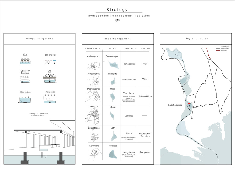
Considering the circumstances, the project’s proposal is focusing on guiding water flow and designing flood areas, in order to decompress water’s urge naturally and prevent flood damages to the settlements along the river.
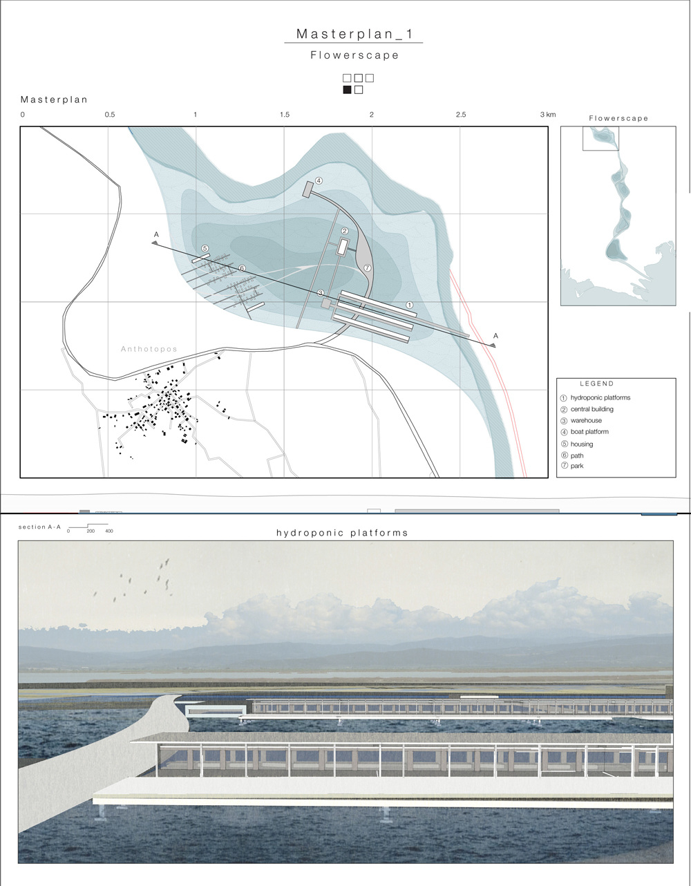
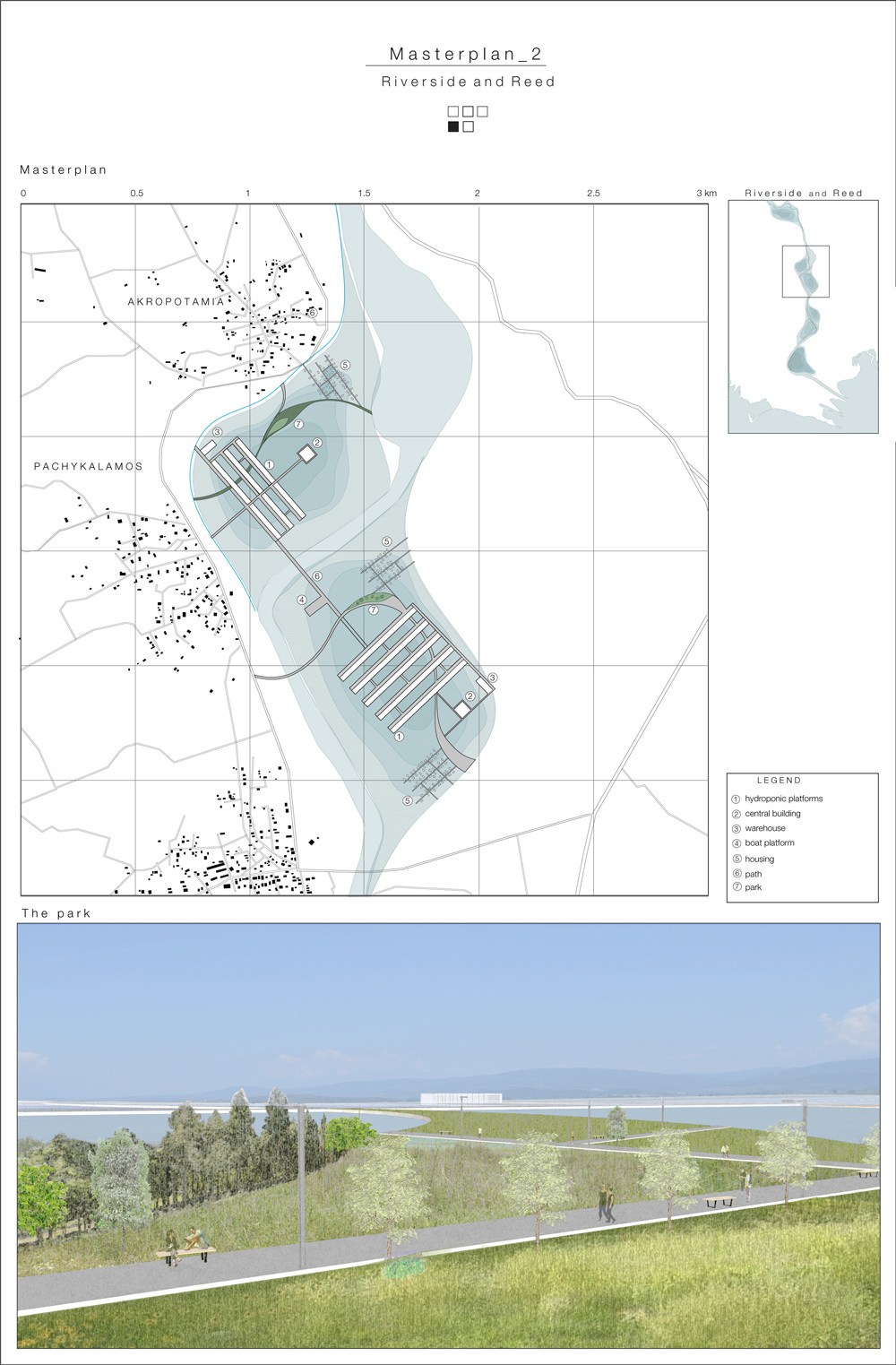
The six successive wetlands that are going to be formed, have been designed properly to be exploited as hydroponic lakes where floated platforms are being installed. Therefore, a new type of cultivation will be introduced to the region and broaden the variety of agricultural products. Each hydroponic lake will be managed by the nearest village as well as the agrotouristic settlements installed in each lake.
A logistic center, in the middle lake, will be in charge of all the coastal shipping and road transports of the products to all over the country.

©COASTAL DOMAINS 2016-2017